
The Pyrénées
/The Pyrénées: the colossal mountain range which forms the natural border between France and Spain, separating the Iberian Peninsula from the rest of continental Europe stretching from the Bay of Biscay to the Mediterranean. In contrast to the Alps, which possess a huge number a deep glacial lakes, the Pyrénées have an large number of small alpine lakes and a large number of alpine torrents – very similar to both Norway and Sweden. Arguably the most distinctive feature of the range is the abundance of semicircular precipitous cliff cavities, so-called cirques. From a mountaineering point of view, the Pyrénées are distinctive due to both the rarity and high elevation of mountain passes (cols), which makes any traverse non-trivial. So when it came time to plan a summer hike, they seemed like the perfect choice.
Planning
Organising a week-long hike requires a fair bit of planning. There is a big difference between saying “I want to go hiking in the Pyrénées” and having a detailed route mapped out along with having all logistics sorted. Firstly, I knew I wanted to be in the meat and vegetables of it all, not the foothills, which basically means the central region, or the French province of the Hautes-Pyrénées. Secondly, I wanted a trek, a challenge, not just a stroll through the hills. Admittedly, I found information on the area quite scarce. There are a lot of tourist guides for seeing the main features or driving around for day-walks, but not so much for extended walking. There is a lot of information on El Camino Santiago and on the GR10, but not much else. The problem with the GR10 is that in a lot of places it avoids the big peaks and stays low, entering towns; the exact opposite of what I was looking for.
So after a lot of time on google maps, I decided walking along the border to the south of Lourdes was my best bet. My initial walking route came from the google maps trail feature, which allows trails to be viewed whilst in terrain mode (which was news to me at the time). Using this, I cooked up a plan and then went and purchased the relevant maps (IGN maps 1647 OT and 1748 OT) so I could plan in detail. One of the real difficulties was trying to know how far one can reasonably walk in a day in unknown terrain. In Australia, I usually ball-park a speed of 5 km/h on decent terrain and 3 km/h on hard terrain. But some hiking in the Alps last year left us reeling in sections, going well below 1 km/h. I set a target of 25 km/day to not be too crazy, and in the end this was about right. Another concern was the alpine refuge situation. My experience in the Alps involved staying in refuges, which are simply bizarre when coming from Australia; the idea of a bed, supplied with linen and a hot cooked meal with a beer while in the wild is just crazy. Any information I found regarding the Pyrénées stated that camping was illegal, so I had planned on hitting the huts, but often they are inconveniently spaced and not in the most remote reaches. That being said, some are mind-bogglingly remote! So I hatched a plan to illegally camp at night, which would be harmless. It turns out that this is exactly what one is meant to do (if they want to camp). Provided the tent is erected after 1900 and removed prior to 0900, it is all good. Why this is not stated on the website I am not sure, but here’s hoping someone finds this information!
Getting there and back from Paris is a bit of a mission, but is very possible. The hardest part is getting into the real mountains. There is a TGV which runs from Paris to Bordeaux and on to Tarbes. The regional trains in this area are few and far between (understandably) so all transport is by bus. However, finding routes is near impossible. You can only get times once you know the start- and end-points, so when you want to know where the buses go, it is infuriating. It ended up as a very tedious trial and error guessing game for towns, seeing how close to the border I could get. The final plan which was ultimately locked in consisted of: Paris – Pau (TGV, 5h30), Pau – Lourdes (bus 1 h), Lourdes – Argelès-Gazost (bus 30 mins) with a return trip from Saint-Sauveur – Pierrefitte-Nestalas (bus, 15 mins), Pierrefitte-Nestalas – Lourdes (bus, 40 mins), Lourdes – Pau (bus, 1 h), Pau – Paris (TGV, 5h30). With everything organised, I had to simply pack and start walking.
Training day
As I wanted to get as much walking as I could fit in on the first day (being unsure of distances and such) I took the earliest train I could, which left Paris at 0620. All loaded up, I took the first metro (which is the first time that has happened) and made my way to the station and settled into my first class seat – which on an older TGV is not saying that much – and heard a delicious announcement that the train would be going all the way to Tarbes and stopping at Lourdes, meaning I did not have to change to a bus at Pau. This was excellent news. It also meant that I arrived in Lourdes earlier and in time for an earlier bus to Argelès-Gazost. I arrived in Lourdes and was immediately greeted by some very average weather and many old people. But as the bus was meant to depart a minute or so after the train arrived, I hauled ass to get on, only for it to sit there and let all other passengers load on. This is exactly what should happen with connecting trains/buses, but since I had been stressing about catching it, it was rather unsatisfying.
We had a drive through the outer suburbs of Lourdes and then onto the highway toward the mountains. The clouds were thick and it was raining heavily, so I couldn’t really tell if the mountains were there, but I could imagine. The bus dropped me in Argelès-Gazost, which was a quaint little town, it boasts a water fountain and a very confusing road system. As I only had 1:25 000 hiking maps, there is not enough detail for town navigation, so I had a bit of trouble getting to the required road, but at least I got to walk through the town graveyard. With some aid from google maps, I was on the right track – and the use of my phone here would have consequences later – and all that was left was to get on with it. As I had intended on arriving at about 1430, I had provisionally set a target of 20 kms for a half day, but as it was all flat walking it seemed reasonable. In actuality, I set out at about 1300, so I would have plenty of time. What I hadn’t anticipated that the entire route was road walking, and it was a narrow, windy road with no curb space and enough traffic to keep you on your toes. It certainly was not the most scintillating walk I have done, especially as everything clouded over and it was raining the whole time. I walked through 3 or 4 “towns”, but “collection of 3 buildings” would be a more appropriate name. Occasionally the clouds would separate and I would get a view of a cliff or so, but the farmland was enough to keep me happy. It was really peaceful, but I could certainly feel the different climate, that is to say the humidity the area is known for was around. I knew if the sun did show its face I would be in a veritable sauna, but luckily this only partially manifested itself. What I did notice though was the abundance of small creeks, which are not really small at all. I always hear about how bad the storms can get down there, and how bad the flooding can be, when you see how much water is going around you do start to gain an appreciation for how easily that could happen. A much more annoying thing to notice was the existence of bus stops, I noticed two, from the same company I used, one sitting in the middle of nowhere and the other in the township of Arrens-Marsous, which I wish I had known about, as that would have saved a lot of road walking. But not much I could do about it! Arrens-Marsous was the town where I would continue south and finally separate from the main road and follow a road which ultimately terminates at the information centre of the national park. This road was a more interesting walk, as it was much steeper and followed a torrent, making made things seem a bit more like what I had come to see/do. Adding to the joy was the movement of the clouds. It did not clear, but the rain basically disappeared and I was obtaining glimpses of snow-capped peaks. About 6.5 km from Arrens-Marsous is Le Lac du Tech, which was my planned resting spot.
At the lake, there is a refuge with a campsite surrounding it, but when I arrived, it was a construction site, with the construction providing wheelchair access. I thought this was pretty swell, as there are not too many mountain oriented things with disabled access! But my planned campsite was non-existent, which was a bit of a worry (particularly as I didn’t know about the camping rules at this point). As the workers were still around, along with quite a few people who were fishing in the lake, I ditched my bag and walked around a bit. The lake was quite pretty, and was fed by an absolutely roaring torrent which had some pretty cascades. As time passed and the weather began to deteriorate, I decided that I would just set up camp and see what happened. I found a nice spot just next to the cascades, pitched the tent and settled in. At this stage it was about 1830-1900, but due to the bad weather it was pretty dark. I fired up the stove and boiled some water to hydrate my “space meal” (also known as a dehydrated meal). I had never used purpose-made hike food as usually I would make my own, but it was just the most practical way when the provisions for a week are taken into account. Not to give a sales pitch, but I had meals from “Voyager”, and they were delicious, and really filling. Since then I have eaten a few of them on other trips and they have gone down a treat. Voyager, le repas en liberté.
After dinner, it was time to settle in for some sleep. Not long after, I hear a car pull in not far from where I was camping at an area which I had surveyed as a potential campsite and start setting things up, so my mind was put at ease about camping, and with that, I drifted off.
Border patrol
I had set my alarm for 0600, to try and catch the sunrise – although my hopes for seeing anything with the heavy cloud cover were not high. It was certainly pretty fresh; even though I was only at about 1100 metres up, there was frost everywhere and to my great joy, not a cloud in the sky. Being summer, the sunrise was around 0530-0600, but being down in the valley meant that I was not going to receive any direct sunlight for a good few hours, however all the mountaintops were beautifully illuminated.
After some breakfast and packing up the tent, I was on my way. The day’s rough plan was to head to Refuge Wallan and stay there, going via Port de la Peyre St-Martin which is on the border and then over the Peyregnets de Cambales. With the Col de Canbales coming in at 2706 m it was going to be a bit of uphill. I continued along the road I had walked in on and passed the group who had set up camp after I hed put myself to bed and noticed that at some other time another group had turned up. Not far up the road, the valley really opened out and combined with the fast flowing river and the sun-tipped mountains made for quite a nice sight.
Following the road for a few kilometres, I arrived at the maison du parc and the end of the road, meaning that it was finally time to get on the hiking path. Arriving at the maison, I was greeted by a 9 or 10 year old girl who was in the river (which considering the flow speed and temperature is a good effort) and was hauling out a drenched sheep! There was a large truck in the process of unloading a few hundred sheep, obviously going out to pasture. Not giving it much thought, I set off on the path which had an immediate gain of 100 or so metres and encountered a sign – both physically and metaphorically. It was what I had searched for, all the information on park rules. Why this can only found on the park boundary is just crazy, but I had eventually found it and read that camping is allowed in the park (for the times previously mentioned), as long as it is at least an hours walk from the park boundary. Not quite sure about that condition, but it made me happy to see that I could camp legally. So pushing ahead I came upon lac de Suyen, which was really quite pretty – if a little muddy.
Meandering along, the path was a steady gradient, but really rather friendly walking. Due to the presence of the maison du parc and associated car park, there were a few people around, most without packs and who were all impressed by the size of my pack, as it is very uncommon here to have a “complete pack”, that is something you can be isolated with for a week and not need external supplies. Continuing on, there was a small diversion to visit the Doumblas waterfalls, which were quite pretty, but were impossible to photograph due to being in the direct sun. However, during my time attempting to photograph them, the graziers with their sheep had arrived. They were really going at pace and overtook me on my diversion. What I hadn’t counted on was the inability to overtake said sheep, as everyone was confined to the path due to the terrain. So I had a chat with some other hikers who were also trapped, and they informed me of a very well-known day walk in the area which circumnavigates the Picasse de Labassa. Once the path opened up, I took the opportunity to get ahead of the sheep and soon arrived in the saddle in-front of Picasse de Labassa, and it is quite a spectacular spot.
It was obvious that the aforementioned hike was well-known, as there were a mass of hike tour groups here, probably numbering up to 50 or so people. However, they were all going west, and my track was heading east and not one person was taking it. The first kilometre was really quite rough, gaining 250 meters or so, but even afterwards the gradient was much steeper than previously. The landscape was becoming much harsher as well, with the valley narrowing and deepening at the same time. It was not long before the snow started appearing – which was good as I was starting to run a little low on water! I passed the Toue de Casterie emergency shelter (as marked on my map) but was only able to locate a small pile of rocks that vaguely formed a square, so perhaps that should be stricken from the map!

Some lunch in Spain. A sign indicating that you are entering a national park (and hence France) lingers in the background
It was probably an hour or two before I arrived at a Col, and was totally confused as to where I was. I was expecting to arrive at one, but it was the border, so I imagined that there would be something. But there happened to be some people walking up from the Spanish side, whom I asked “is this the border?” to which they replied “yes”. It was a little disappointing. From the Col one cannot see much, but from my map I knew if I walked a few hundred meters into Spain I should have a nice view. So I ditched my pack, grabbed my lunch goodies and went into Spain for lunch.
After lunch, I begun the (extremely rocky looking) ascent toward the Col de Canbales. I would have been on the trail for only 5 or so minutes before I heard some women screaming in joy at the sight of me. Usually that is pretty standard practice, but this was different. I continued climbing up and they made their way down and then started blasting at me in Spanish. I communicated to them that we could converse in French or English, but not Spanish. Unfortunately, for them, it was Spanish or nothing. Insert 10 minutes of pointing and acting and the conclusion I reached is that they had driven their car in on the French side, walked to a refuge and stayed the night before, come over the next valley and now wanted to get back to the car. So if you remember one of the things I said makes the Pyrénées unique is the lack of mountain passes, they had two options: go back the way they came or walk the way I came, and then back to the car, which was probably 50 or 60 kms. They had no packs, only hand held water bottles. So, on my map I pointed to the closest refuge and made the gesture of go there and find someone to communicate properly with. They certainly were not in a good situation and hopefully things panned out well for them!

A look into Spain from the border
Continuing the climb, it began to become very difficult. On the map, the climb is marked as passage délicat (meaning difficult path) which from my experiences over this hike and others, means anything from quite steep to loose shale to light glacier travel. A very large snow section made me reapply sunscreen for fear of getting burnt and during this time, some other hikers passed me. With me following them, we mounted a brutally steep gully, which became glaciated halfway up our ascent. Without crampons, I was struggling a little, but pushed on and after about 45 minutes we were at a Col. Disturbingly, from the top all I could see were two (very pretty) half frozen blue lakes. The reason this was disturbing was that there should not have been two large lakes where I was going. I introduced myself to the people I had been walking with, who were also Spanish, but luckily one of the two spoke rudimentary English. We determined we were going to the same point, but could not agree on where we were. One of them nipped off to have a look over the ridge whist I whipped out a compass and tried to locate us. From where we should have been, I just could not figure it out. “The only place where there are two lake on this bearing is… oh no, back in Spain!” So I slowly came to the realisation of where we were, and that the entire climb was wrong. However, I could not convince my companions of this and I did not want to just bail on them, as they did not have a map. It makes you appreciate how hard arguing with minimal language is! So my final play was to hope somehow I could get some phone signal and google maps it up. That was optimistic to say the least, but magically, as I had used my phone in and around Argelès-Gazost, a very low resolution version map of the entire area had been saved. So with GPS, I could show them that we were indeed on the border and not where they thought we were. It did annoy me a little that this convinced them, and not my compass and map, but they were convinced.

Atop a peak near Col de Canbales

The view from the tent, while it existed
They literally started to run down this glacier hand in hand, so I lagged a bit behind as I was not quite comfortable running. We returned to where I had put sunscreen on about 2 hours prior and then found the right path, which was brutally steep, but at least was not snow/ice. After an hour or so we were reached Col de Canbales, which provided some spectacular views over the lakes on the high plateau. I was starting to get pretty tired at this point, but wanted to make it to the refuge if I could. The descent was on the North-east face and was completely snow covered, which made for some slow going and in the shadow of the afternoon sun it was beginning to become cold. The plateau of lakes was 2 kms away and was so pretty, that I decided I was going to set up camp there, which was the exact same thought my Spanish amigos had had. So I found a nice grassy patch nestled next to a lake and not far from the river and set-up for the night. I was in the prefect spot to have an amazing sunset, but as I was setting up, the clouds rose up and buried everything, which was a bit disappointing. But it was the first time since I had purchased all my hiking gear that I gotten to test it at height; I was still at 2500 metres. It was the first time I been in my sleeping bag without cooking; it was so cosy that I was out like a light.
1000 metre sickness

A church next to Refuge Wallon

Lac d'Arratille
The following morning I again awoke to perfectly clear skies, so after donning some sunscreen and packing up, I made my way toward Refuge Wallon which was on the valley floor, located about 1000 metres below. The walk was really nice, as the previous day’s walking was on fairly harsh terrain, the morning’s walking was through the trees and one could see the lush valley pastures – along with hear all the bells from the alpine grazers. The drop was prolonged which really starts to have the knees feel a bit ginger, but after an hour or so, I arrived at the refuge. One thing I will never understand about this part of the world is the location of chapels/temples. Not 500 metres from the refuge, in the middle of nowhere is a temple from the 1800s just sitting there. It is certainly picturesque, but whom does it serve? Anyway, I didn’t hang around long and continued on my way back to Spain, which meant back up.
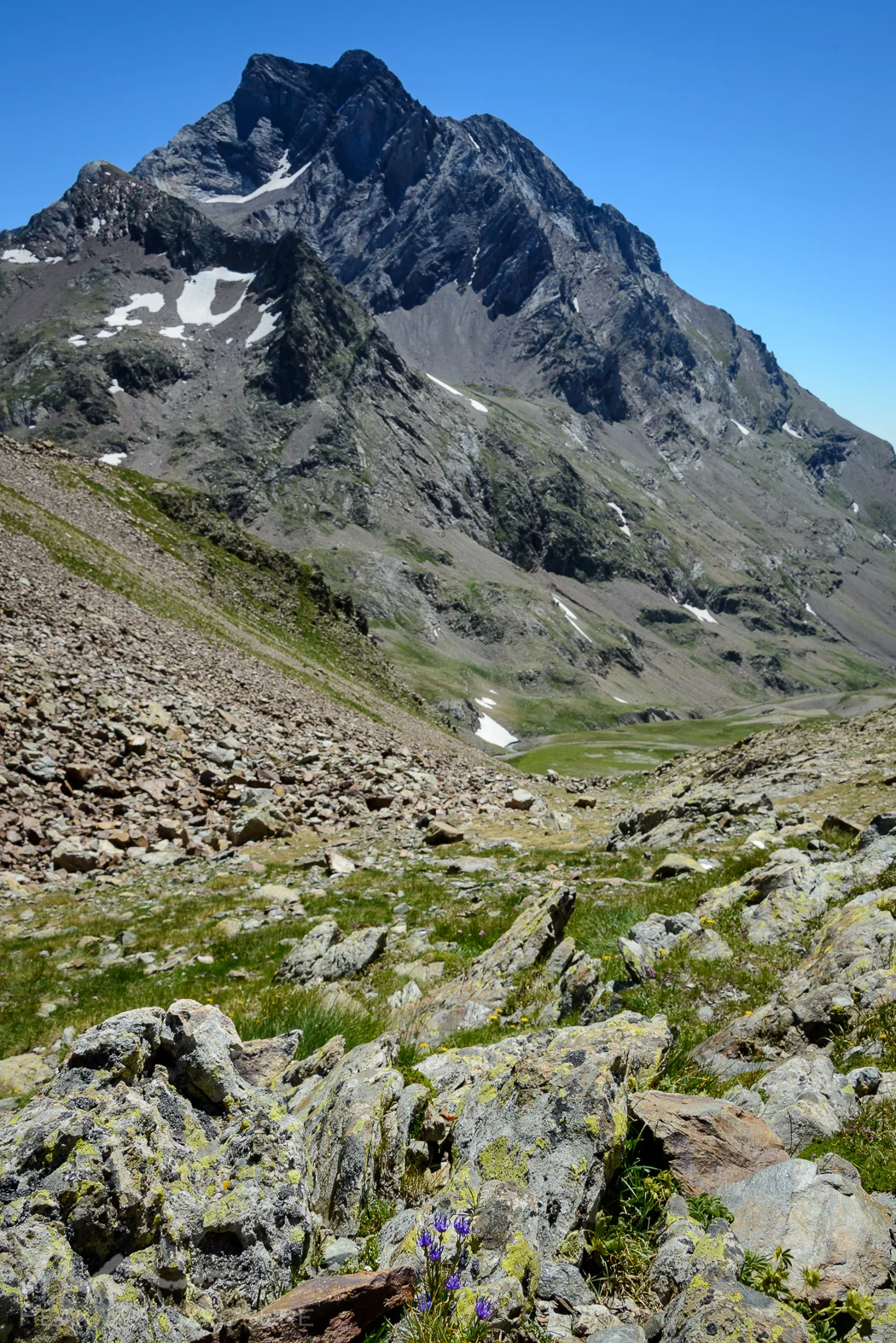
The walk was still in the trees which was refreshing, but then broke out onto large (well, massive) boulders which combined with the sun rising over the surrounding mountains made things less pleasant, as I was paranoid about getting sunburnt. A moderate climb brought me to Lac d’Arratille, a large lake fed by a pretty cascade which had quite a few people fishing and relaxing on its banks. I assume as it is not too far from the refuge it would make a nice day-walk if you didn’t want to exert yourself too much. The path which continued on to the border certainly looked very intimidating, as it was all shale and switchbacks the entire time for a gain of 500 metres in about 1.5 kms. Climbing it (as always) was not as bad as it looked, but it was pretty tiring. Arriving at Col d’Arratille, the views were stunning, so once again I was in Spain for lunch. Whilst enjoying my lunch I was admiring Vignemale, which at 3 298 m is the highest of the French Pyrenean summits. It is flanked on the Spanish side by a cirque, the Circo del Ara, which is quite a sight to behold.
Vignemale from the west
The afternoon’s walking was on the cirque, which is again a passage délicat, but this time it is because, although you are walking without changing height too much, the surface is on a huge angle (30 to 40 degrees) and it is all shale, except when it is snow or ice. Needless to say it was slow going here. After an hour or so, I arrived at Col des Mulets, and was a little disheartened by the ruthlessly steep downhill that was on the other side, heading down to the Oulettes du Vignemale. The valley is wide open and very well watered due to all of Vignemale’s glaciers. But I had to drop the recently gained 1000 m and get down there first, which was slow going due to snow and ice. At the bottom and out in the open was another refuge, refuge des Oulettes de Gaube, which is massive – obviously as people want to come and see Vignemale, which has quite a distinct shape. I had thought about staying here, but once I saw the refuge, it was obvious that it was not a place I wanted to be. I actually ran into my Spanish amigos here, not knowing how they got here ahead of me since I had left before them, but I didn’t ask the question. There were many people with binoculars watching for people on Vignemale, as I heard some people had left that morning for the summit. With energy still left in the tank, I filled my water and reapplied sunscreen and then made my way back up the other valley wall, aiming for the near-by Refuge de Baysselance, which exists to facilitate summit attempts. Taking back the 1000 m again was not so easy, as my legs were well ginger by this stage, so the climb was slow. Not to mention it was a very rough climb, again a passage délicat, primarily due to its steepness and poor footing. After 90 or so minutes I had reached the Col and then it was only another 20 or so to the refuge. The terrain here was hard, both literally figuratively with little/no vegetation and large rocks everywhere, so finding a campsite was not so easy. But semi-constructed rock piles make supporting a tent much easier, so I found a place to settle in.

Vignemale, from the north

The campsite near Refuge de Baysselance, looking toward la brèche de Roland
As I was camping next to a refuge, I took my dinner there, which was delicious. A thick vegetable broth followed by some slow cooked lamb stew and finishing with chocolate coated pears for dessert really hit the spot. I met a nice family to pass the meal with, but once the eating was done, I was straight to bed and straight to sleep as I was buggered.
The long road down

Sunrise from refuge de Baysselance
I awoke yet again to perfectly clear skies, but very little light as the area was surrounded by massive peaks. Not to mention I was up well before sunrise as I had organised to have breakfast in the Refuge and wanted to be all packed before taking it. It was around this time I noticed that my feet were starting to feel a little ginger, but I guess that is to be expected after a few long days. I headed in for breakfast, which was an absolute scam, 8 euros for 5 slices of stale bread, but I guess it is not easy to come by up there. That being said, I remember having a massive dinner with a few beers, along with prepaying breakfast and getting change back from a 20 € note whilst in Tyrol, Austria. But I digress.

Not far from the Cabane de Lourdes
Leaving the refuge I was treated to some stunning light, illuminating my target for the next few days, La Brèche de Roland. From this distance, it was a tiny break in the cliffs, but the plan was to camp at the base that evening and ascend the following day. According to my map, there was a tiny town called Gavarnie which I assumed to be large enough to have a small supermarket that I would be able to stock up at. But all that was a long way off. The way down the north-east face is glaciated and steep. There were a lot of climbers in the area, so the foot holes were well-worn in, but it was still seriously steep. There was about 2 km or brutal terrain, dropping very steeply and then remounting to traverse the gullies, which I am glad I faced in the morning. As I neared the bottom, I passed many groups who were embarking on their climb and I did not envy them in the slightest, I would estimate it to be a rougher ascent than the one I had taken – but then again it is hard to know. But certainly there was a lot more snow and ice; that is it was almost entirely snow and ice. After having lost nearly 1500 metres, I arrived at the head of a super lush valley, the centre of which marks the national park boundary, with the south being in the park. After walking through a sea of cows for 20 minutes or so, I arrived at Lac d’Ossoue. The lake is host to a car-park, and hence a lot of people. Not so many at the lake itself, but rather it is the starting point for many a day-walk. So for the next hour I so, I was walking with a family group of about 15 or so, but not talking to them (as they did not speak French) so I was just mingling between them.

Looking back on Vignemale

Not a bad spot to camp
After a moderate climb, I arrived at the Cabane de Lourdes, which is a little farming shanty. The path from then on was relatively flat, winding along the valley wall. It was a really nice walk, much more relaxed than the previous couple of days. After a an hour or so of walking, I found a nice place to sit down and have some lunch and just lay in the sun for a while. From the cabin it was probably 10 or so km but I was really on cruise control and it took me close to 3 hours to cover the distance. As the path is mainly flat but the valley floor was continuously descending, the kilometre has near a 500 metre decent. It was during this I first spied some real civilisation, with a steep sealed main road winding up the hill, vaguely in the direction of the border. As I did not know what Gavarnie would hold, I thought that I might stay at the refuge on the way down into town, les Granges de Holle. Whilst this would have been nice, the place was fenced off with a sign that basically said go away. So not knowing what that was about, I decided to continue to a campsite on the other side of town. However, Gavarnie was not at all the little town that I expected it to be. As I navigated my way down the hill and made my way to the main drag, a view I will not soon forget: le cirque de Gavarnie. It is absolutely colossal; covered in glaciers and home to the largest waterfall in France, it is certainly one of the most spectacular things I have ever seen. However, such beauty comes at a cost. The image of the small town I had imagined Gavarnie to be was quickly replaced by a town full of tourists, tour buses and more people with walking sticks than you could poke a stick at. It was quite a shock to come from a lovely tranquil couple of days alone, only to be shoved into tourist central. So I made my way briskly through the town and found the campsite. I dare to say the campsite holds one of the best views of the cirque and I was pitched in an absolutely prime position. There is a very large torrent fed by the cirque running through the town so I went down there and had a bit of a wash, as that was the first good opportunity to do so; but the near zero temperature made it pretty hard work!

Le cirque de Gavarnie
In the evening I ventured into town to pick up some supplies, and decided that I would have dinner whilst I was there. I found an empty restaurant – which was not so hard since the town is small with few hotels and hence everyone daytrips – and snuck in the local delicacies. I had a big pasta dish along with some Basque tart, which was pretty tasty. I also had a beer, which went down a treat. Since I had no idea how long it would take to climb the cirque, I figured it best to get an early start, particularly as the weather was meant to turn the following afternoon, and once the sun went down, I did my best to follow it.

Sunset over the cirque
Breaching the gap
I rose bright and early and headed out on the path for La Brèche de Roland: a 40 metre wide and 100 metre high gap that is undoubtedly the most famous pass in the Pyrenées. The legend goes that after Roland lost the battle of Roncevaux Pass in 778, he took an (evidently) large swing of Durendal, his sword, in an attempt to break it, but the brèche was the result. My plan was to ascend up to the refuge des Sarradets, which is only a few hundred metres from the brèche itself and stay the night there.
The path from Gavarnie is well trodden, but that does not mean it is easy. The climb is approximately 1700 m in about 10 kilometres, but it is very staggered, that is to say there are relatively flat sections mixed with some extremely steep sections, however it is nice walking nonetheless. After an hour or so, I reached the cabane de Pouey Aspe, which is a shack, but it would have been amazing to camp there. I had thought about it the day before, but I couldn’t face the climb so I stayed in town, but given my time again, I would definitely set up camp there.
There were a few people on the trail, but I found myself walking at the same pace as an elderly couple during the climb to the Port de Boucharo, which is a long climb up through a very pretty valley. Unfortunately due to all the cattle, it was a bit of a mud pit in sections, but overall it was really quite pretty – although very fresh, as you are constantly in shadow. We arrived at cabane des Soldats at which point two things happened: the terrain became much steeper and the path became much less obvious. We could see the Port so there was little to do other than head straight for it, but the massive boulders which line the valley made for really tough walking. And it only kept on getting worse as we went up. Adding to our suffering was the appearance of people at the top, taking a leisurely stroll from their cars at the nearby car-park of Col de Tentes. After a slog we arrived at Port de Boucharo and I initiated some conversation with my walking buddies, just “that was not so easy, blah, blah” and during our conversation we noticed where a much better path would have been, which turned off at the cabane des Soldats. It was at this point I wanted to say “yes, well we just made a mistake”, but I accidentally said “yes, well you just made a mistake”. I was too slow to correct myself so instead we just dealt with an awkward silence. We said our goodbyes and then I continued on the path to the brèche.

Looking over the cirque on the way up
The section between Port de Boucharo and refuge des Sarradets is somewhat interesting, for lack of a better description. It is the steepest part of the climb, with the passage délicat reappearing, mainly because one must scramble/climb through a waterfall. The waterfall is fed from the looming glacier du Taillon, which means the water is deliciously fresh, but also very cold. Adding to the fun is the presence of families who have driven up and want to walk up to the hut for lunch. Obviously people do not realise that one has to have some level of climbing ability, so there were large pileups of people at certain climbs. Some people – myself included – ditched the chain lined climb and went up the face as there was a young boy having a tantrum and refusing to move after climbing to a spot from which he could not escape. The direct route leads up onto the glacier and shortly after to the cabin. I arrived at about midday, which was much earlier than I had expected, and it was around this point that I decided that I would attempt to descend in the afternoon. The weather was visibly closing in, and if I could avoid it, I didn’t want to be trapped up there for a descent in bad weather. However, before descending I had to see the thing I had climbed up to see - the brèche. So I had some lunch, left my bag at the refuge and headed up the glacier de la brèche.

La brèche de Roland
As I have mentioned, there were a lot of leisurely strollers, and on the glaciers this did not change but it was much more hazardous. The path is only 300 or so metres, but with an elevation gain also of 300 metres. The initial climb is on shale and it is very difficult to keep a solid footing. Once on the glacier, the path would be more accurately described as an ice slide and it is full of people who have no idea about walking on ice, so it is an absolute mess. Teaming up with a group of 3 older women, we went out on the open ice and it was smooth sailing. Everyone was making a bee-line for the top, but we diverted up the glacier to get a view of the brèche and its surrounds. The cliffs in the area are absolutely colossal. What I found most remarkable were the folds in the sedimentary strata; the range of angles that exist in the same mountain is unbelievable. I stayed only briefly at the top as I wanted to get down before the storm came, and the clouds were closing in. Down off the glacier, I collected my bag and headed east, more-or-less into the cirque. The route is much more direct, coming in at about 2.5 kilometres to the valley floor and then another 3-4 kilometres back into Gavarnie. The initial path is very rocky – many large boulders and I doubted the existence of the path on more than one occasion. I found a little lookout about a kilometre or so down, which gave a fantastic view of the cirque and its waterfall. There was little here other than the cliffs of the cirque itself, which was absolutely breathtaking. But again I did not stay long due to the imminent storm.

La grande cascade de Gavarnie, the largest waterfall in France
The path became ruthlessly steep, and my knees were letting me know about it. The combination of a long hike, a lot of downhill the day before and me trying to haul-ass to get down was punishing. The whole time I was waiting for the hard section (marked as a passage délicat) and once I hit the crazily steep section I knew I was there. Only the path was the opposite direction as indicated on my map. I pushed on, only to find in a few hundred metres the real hard section. Usually I do not moan about bouldering or mild rock climbing, but this was proper rock climbing. The group ahead of me was roped in and there I was with nothing. Well, at least some people who were nearby to help me out if things went pear-shaped. So trying to descend this passage efficiently and safely as the rain was falling and with lightning cracking away every few seconds was quite the experience. But I just wanted to get off the rocks, so I pushed on.
It was a real relief getting off the wall and into the valley, but there was still quite a walk to meet the track which goes to the waterfall. Unfortunately, as soon as the terrain flattened out my knees no longer wanted to work, so my speed dropped drastically; at least I was off the mountain. One can always see the track to the waterfall, as it is crowded with tourists, but coming off the cirque there was only me and the climbing group, so we really stuck out. Making matters worse, the bridge to cross the torrent to reach the path had collapsed during the spring floods. So there was a little improvising required to cross it; along with the climbers, we rigged up a rope support and we able to cross without too much trouble. Then there was the long walk back into town. As I was not staying at the brèche, I had initially planned to try and continue past Gavarnie to another hut, but in the condition I was in, that was not going to happen. Cruising along at a snail’s pace, attracting a lot of attention due to my large pack, and what I could only guess were people’s thoughts of “why has he got such a big bag for going to a waterfall”, I made my way back into town. After about 1 and a half hours and having covering only 3 kilometres, I arrived back at the campground. I again set up my tent, wondering how I would be feeling if I had only day-packed up. But how was I to know? I went down to the river to have a soak, but all the rain had turned the torrent into a menacing beast and one would have to be crazy to get in. It was very interesting however, as the area is renowned for the big storms, rising rivers and flooding; having had only an afternoon’s rain and seeing rapidly the conditions degrade, one can gain an appreciation for why it is indeed so renowned. But I was in no state to do anything, so after laying in my tent and listening to the rain, I had a quick dinner and then it was lights out.

Atop the glacier de Roland
De la chance
I awoke to miserable conditions; the storm had been raging all night and there was little end in sight. I was still feeling ginger, but I wanted to get on my way. So with everything packed up, I set my sights on Luz-St-Sauver. The plan was to walk there, stay the night and then catch my bus the following morning. The walk is about 20 kilometres, but in a similar style to my first day, namely flat and not so mountainous. The less exciting walk, combined with the weather and my ginger-ness did not make for the most motivating concoction. On my way out of Gavarnie, I happened by the info centre and discovered that a bus services Gavarnie (something that I had not found during my research). With this information, I hatched a dastardly plan, to cut my walk short and head home. As luck would have it, when I checked the timetable, there was a bus in a little over 20 minutes going to Pierrefitte-Nestalas. I had a ticket to go from there to Paris, so it was all good. It was about 0830 in the morning, so I thought that even with the meagre bus schedules in the area, that I would be able to get to Lourdes by evening and then catch my train the following day.
Whilst waiting for the bus, I read a plaque at the information centre which was extremely interesting, so much so I am going to recount what it said here. During 1669-1670, Abbé Jean Picard measured the length of a degree of latitude and from this calculated the size of Earth. In addition, the meridian line as determined by Picard, tracing through l'observatoire de Paris, would be used as the prime meridian for the world – well if the French had gotten their way. Along with the Greenwich meridian and the Antwerp meridian, it was a prime contender of the prime meridian. But with the invention of railways there was a need for synchronised timekeeping, and as such, an international standard for both position and time was needed. The international meridian conference was held in Washington in 1884 in an attempt to establish an international standard. Along with many technicalities of the system, the main point of contention was where the prime meridian should be. Obviously each country argued that it should be in their own country, but the aforementioned cities of Greenwich, Antwerp and Paris were the only real options. When it was obvious that no-one was going to cave, France suggested that the line be neutral, cutting neither America nor Europe. But this was impractical due to the lack of accurate mapping of areas other than America or Europe. So the compromise which was reached specified that Greenwich would be the prime meridian if the United Kingdom and her territories adopted the metric system, and as she was the only country in Europe still using an alternate system of units, the metric system would establish itself as the international standard for measurement.
The bus arrived and I paid my 2 € for a ticket and just sat back. I found a timetable for the entire bus network and calculated that I would have 4 hours in Pierrefitte-Nestalas before a connecting bus to Lourdes. After 40 or so minutes, we arrived and found a bus to Lourdes sitting in wait, which was delightful. After half an hour or so, I arrived back in Lourdes. I arrived at about 1130, which is earlier than I could have hoped! I headed straight into the SNCF outlet to see if I could change for my ticket for the only train to Paris that day. I did not like my chances as the station was absolutely packed with people who had clearly come expecting to be the recipients of a miracle. After waiting an extraordinarily long time for someone who was trying to organise a trip to Milan and wanted to go via Zurich (which I could not/can not comprehend at all), I was able to exchange my tickets and even get a small refund of 1.30 €. Whilst waiting for the train, I finished the last of my lunch materials – and must have looked like a brute doing so; dirty, unwashed, unshaven sitting in a station cutting up sausage and cheese and having mountain bread. But it was delicious. The train arrived, and 6 short hours later I was back in Paris, and just like that, the summer break was over.
The Pyrénées
The Pyrénées is well known as a wildlife haven, which prior to going was quite an enticing prospect as something that one does not appreciate living in Australia is the presence of wildlife; animals are simply everywhere. In what I have seen of Europe, this is not at all the case. You can see the odd bird here and there, but that is about it. So going somewhere where you can see wild animals is a really nice change. Unfortunately, many species have been driven to extinction is the Pyrénées – most notably ibices and bears. The ibex extinction which occurred in 2000 is regarded as a mystery, and it is one of the few species to have been made “de-extinct” via cloning – albeit only for 8 minutes. The Pyrénéan Brown Bear is another story. During the early 1900s, cattle grazing in the region increased heavily, and for the bears, this meant easy food. As a result, farmers began to cull the bears, and in 1950 there was only 70 or so left. In the 1970s and 1980s there was an attempt to save the population, which ultimately failed in the early nineties, with what was believed to be the last bear killed not far from Lourdes. In 1996, three brown bears from Slovenia were transplanted to the Pyrénées where they initially flourished and had some cubs, but eventually became too dispersed. So in 2005, five more bears were transported from Slovenia, four of which were female in an attempt to increase the breeding rate. There are now some 20 bears throughout the Pyrénées, but despite my best efforts, I saw none. I did see a huge number of marmots though, and a lot of spiders. Not quite the same level of excitement though.
Comparing my experiences with what I had expected from a trek in Pyrénées, it fulfilled my expectations and more. Having spent all my time in the Alps, I had expected the ranges to be somewhat similar. But the Pyrénées are very distinct from the Alps; the phrase I would use to describe how would be “less violent”. Not to say this is something negative; in general the mountains simply lack the ferocity which is characteristic of mountains found in the Alps. But it is replaced by soaring cliffs, raging torrents, lush valleys and the stunning cirques. This mix of scenery along with the area’s rich history makes for something special and definitely something worth experiencing.