
The Romantic Rhine
/
View The Romantic Rhine in a larger map
A place that I had never explicitly planned to visit was the Romantic Rhine, that is, the middle Rhine, which is defined as the region between Bingen and Bonn. The upper half of the section is particularly famous, known as the Rhine Gorge, a 71 kilometre long gorge formed by the constant glacial waters carving their way from high in the Alps into Lake Constance and escaping into the North Sea. The average elevation of the gorge is roughly 100 metres, making for some spectacular scenery. Adding to this are the 40-odd medieval castles built along this stretch, yielding an average separation of only one and a half kilometres between castles. The Rhine Gorge is a UNESCO world heritage site which has meant that the cities that line the gorge are kept pristine; however it has also meant that no bridges have been allowed to be built across the river, leading to practical difficulties. In any case, this area is everything that I think of when I think of Germany, I just did not know it before I went.
Lore or lie?

The horseshoe bend of the Rhine near Boppard
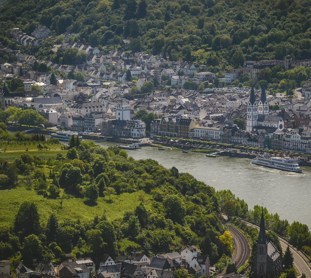
Boppard from up high
Once again my work had brought me back to Mainz, which is only a stone’s throw from the Rhine Gorge. So bright and early on a Saturday morning I purchased a Rhineland-Palatinate state-wide ticket (23€) which grants unlimited travel on non-express services. As I mentioned previously, there are no bridges which traverse the Rhine once you are in the gorge, and whilst there are boats which can ferry you across in the bigger towns, I had resolved to stay on the southern/eastern bank. There are trains which depart hourly and follow the river on both sides, which is convenient should you wish to change sides.

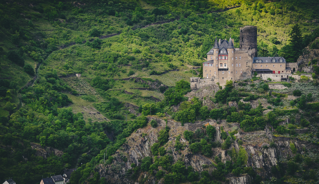
Burg Maus from the southern side of the Rhine

The lush forest of the Rhine gorge
My plan was to head downstream in the morning and work my way back up throughout the day, so the first stop was Boppard. The town is in a famous winegrowing region and is also home to the largest bend in the Rhine, the Bopparder Hamm. The tallest hill in the area, and general lookout point, is the Vierseenblick, which apparently translates as ‘four-lake view’, as the gorge shields various stretches of the river giving the illusion that there are four lakes rather than a single waterway. This point was my first destination - after arriving at the station and picking up a packed lunch with some treats I headed north of the city to the base of the trail. Had I known in advance that there was a Klettersteig, I would have definitely been on it, but instead I took the path which heads straight up the spur. The trail is not long, but it is somewhat steep, rising 200 metres in roughly 800 metres. Arriving at the top, there was quite a nice view over the area along with a restaurant/beer café in a near-perfect location to spend a day. I did not spend much time up on the summit as I wanted to ensure I did not miss the hourly train upstream, so I soon descended. With a little time on my hands, I walked along the foreshore and into the old town where I had just enough time to get a feel of the place before dashing off to the train.

In the fields near Burg Rheinfels

Burg Rheinfels
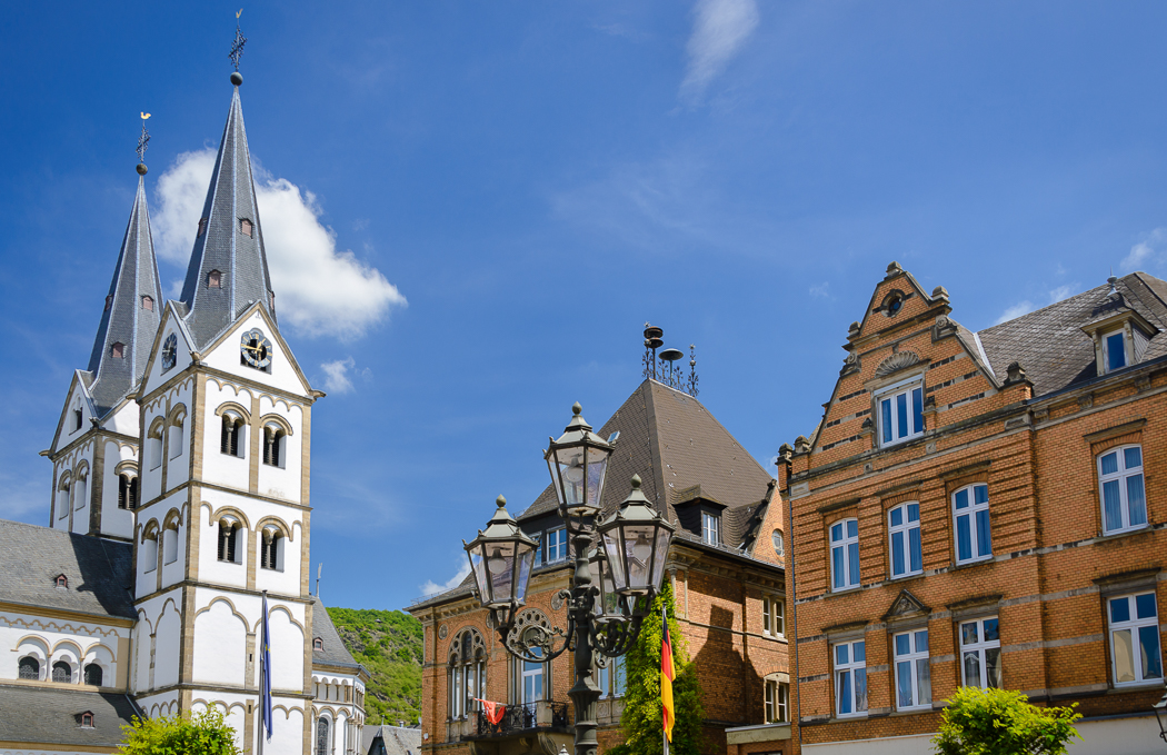
The town centre in Boppard
The next stop was Sankt Goar, a gorgeous riverside town which lies below the ruins of the humongous Burg Rheinfels. A castle a little downstream had caught my attention on the train ride to Boppard, so it was destination number one. Burg Maus is situated three kilometres from town and it is a pretty uninteresting walk between town and the castle, but the castle is spectacular. It is also an excellent spot to get onto the Rheinburgenweg an 195 kilometre trail following the Rhine and passing by every castle (on the south/east side) along the way. From opposite Wellmich, I headed straight up a gully onto the trail, where there happened to be a naked man in the bushes just before I arrived on the plateau. There was a bench at the top where I sat to have my lunch and the embarrassed cyclist who had just been caught out getting changed wished me “guten Appetit”.
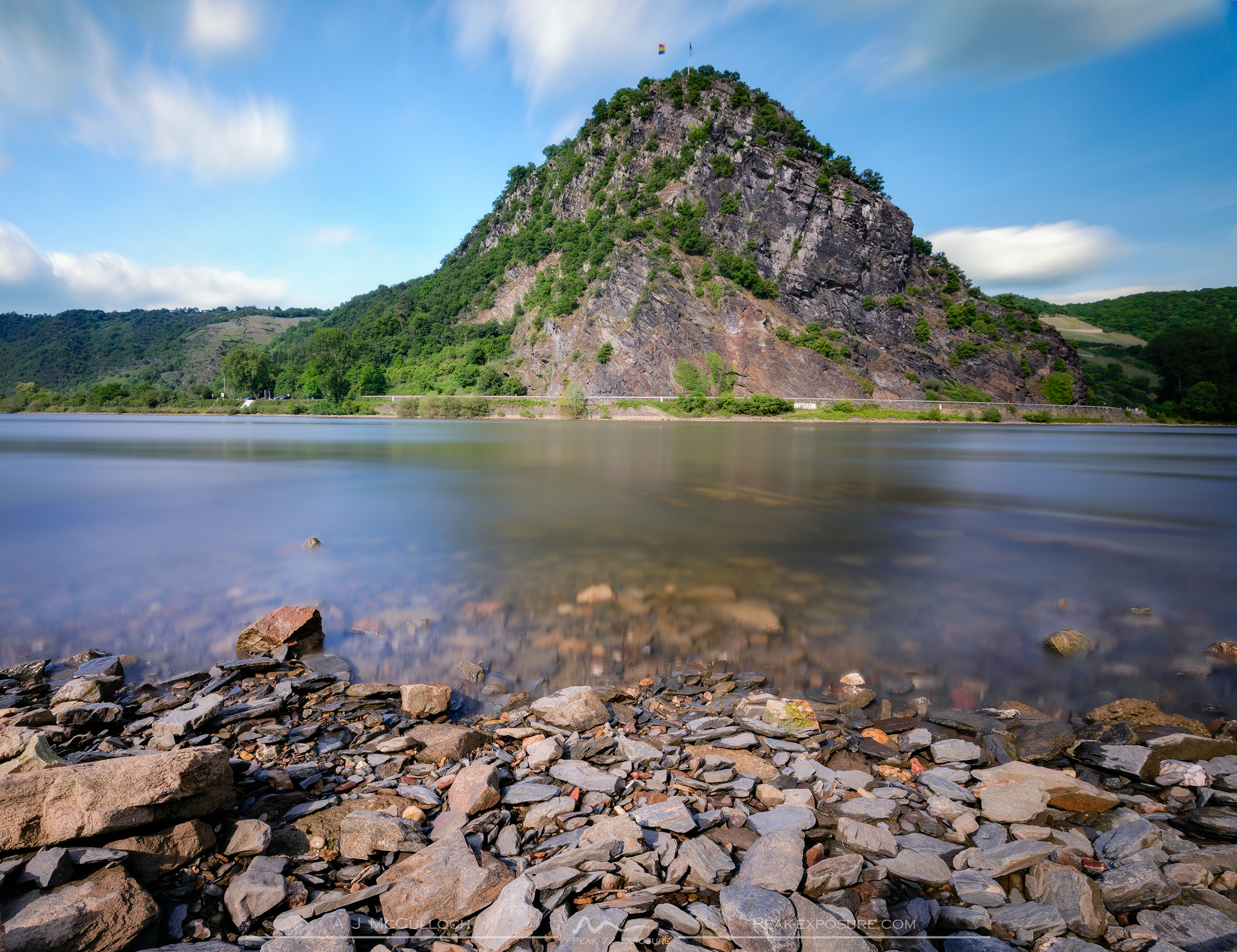
Lorelei in all its glory
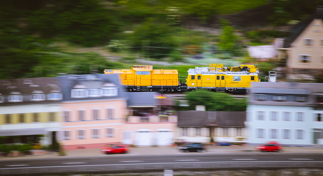
All aboard!
The winding trail stays on the plateau and heads toward the Burg Rheinfels before dropping steeply to the river level though the vineyards around the gorge surrounding the Grüdelback. The trail then immediately ascends steeply to the castle, which given the warm and humid weather was quite tiring. I had also not passed any water sources and was dry by this point, so after a quick visit to the castle I was forced to descend once again, this time into Sankt Goar to pick up some water. Following this detour I once again climbed to the plateau where the trails follows the curvature in the river and eventually arrived at Lorelei. Lorelei is an 120 metre rock which juts out of the gorge, creating the narrowest point in the passage of the Rhine. It is famous, or rather infamous, due to the extremely strong currents surrounding the rock that have annihilated many boats over the years. This history, along with the myth of the feminine water spirit which is said to possess the rock and surrounding waters, draws in tourists more than any other attraction in the gorge. Most people want to mount the rock, whereas I wanted to regard the rock. So I once again descended to the river level, where I was treated to a good view from the waterline. By this time it was late afternoon and I had to head back to Sankt Goar if I wanted to catch the train to my final destination for the day. For this section I stayed on the River and this was an excellent idea, as the view one gets just outside of Sankt Goar when overlooking its sister town of Sankt Goarshausen is pretty special.
Burg Katz

Burg Ehrenfels as seen from Bingen
The sunset back in Mainz
I got off the train at the town of Bingen am Rhine, which is officially the start of the Gorge. The town is much larger than many of the other towns in the gorge and walking around takes a bit longer, so the hour that I had given myself to see the town was a bit tight. I flew up to the dominating Burg Klopp, which offers an amazing view over the surrounding vineyards that are among the steepest I have ever seen, making for some pretty nice scenery. Unfortunately the town’s crown jewel, the Mäuseturm, was undergoing renovations, so all I saw was scaffolding. After enjoying a quick walk along the riverfront it was time to get back on the train and head back to Mainz then into bed as I was absolutely exhausted.
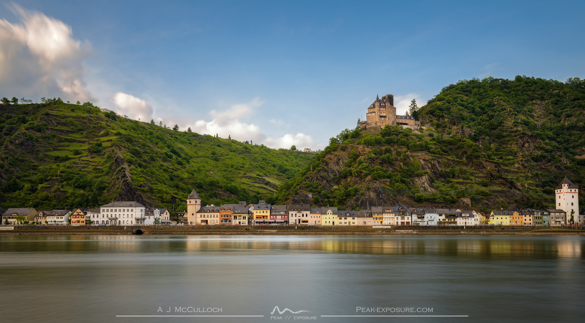
Burg Katz from the southern Rhine
Déjà vu
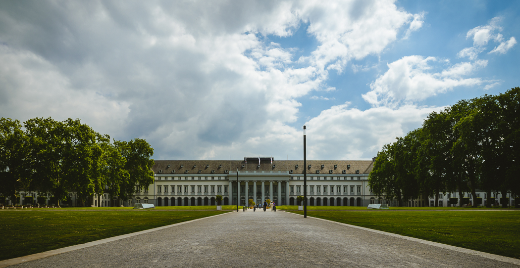
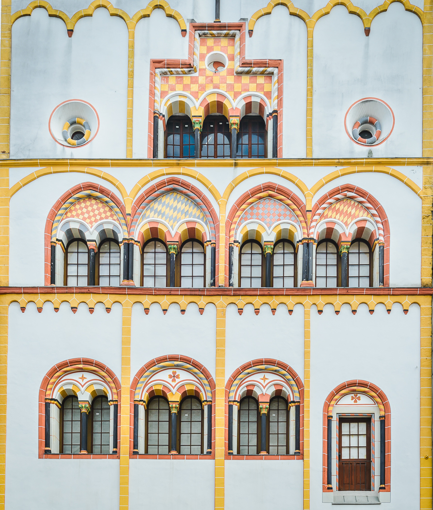
The Electoral Palace, Koblenz

Liebfrauenkirche, Koblenz
Sunday was to be not so much the Romantic Rhine but rather a romantic city, namely Trier. It is possibly the oldest city in Germany, having been founded in 16 BCE. Historically the city was very important; it is oldest seat of a bishop north of the Alps, and the archbishop was one of the electors during the Holy Roman Empire. Situated on the Mosel, a river famous for its impossibly steep vineyards (including the steepest in the world), Trier is a stone’s throw from Luxembourg and a somewhat larger throw from the French border, leading to a really interesting culture in the city. I had imagined that there would be an ICE or IC direct from Mannheim to reach Trier, but the fastest route was Mainz to Koblenz, then Koblenz to Trier, meaning I would take the Rhine Gorge train once again. The total journey time is about three hours, so on the way there I would take the opportunity to visit Koblenz and break up the journey.

On the corner of Marktstraße and Löhrstraße
The Dreikönigenhaus
Koblenz is another old city, founded in 8 BCE; it was erected at the confluence of the Mosel and the Rhine. Indeed, it is this confluence to which the city owes its name. As my main interest was Trier, I gave myself an hour to see that town, which was just about right, two hours would have been too much. From the train station I first visited the Schlossvorplatz where the palace of the Prince Electors is situated. This is a grand building, and while it is not so fancy with its decorations, it is certainly imposing. From here the old town is only a short walk; however it is quite modern due to extensive damage suffered during the Second World War. The Liebfrauenkirche was a standout in terms of pretty buildings, and the Arnsteiner Patres had some gorgeous stained-glass windows. Before long it was time to return to the station, during which I passed by the “four towers”, four stone oriels which flank the crossroads of the Marktstraße and Löhrstraße before reaching the Christuskirche, which was really quite pretty, but the location – essentially in the middle of a roundabout – could be improved.

The Porta Nigra

The Hauptmarkt of Trier

Hohe Domkirche St. Peter zu Trier
The trip along the Mosel to Trier was a blast due to the scenery. It is gorge-like and although it is not particularly high, the terrain is extremely erratic. Before long, I had arrived in Trier where I had a little under three hours to explore before I had to be back for my return train. Destination one was the Porta Nigra, the city’s 1800 year old gate. The gate is in immaculate condition and is enormous, dominating that side of the city. Nestled in behind the gate is Simeonstraße, the city’s main street which leads to the Hauptmarkt. Along the way is the Dreikönigenhaus with a pretty façade, but the Hauptmarkt is really the main attraction, with beautifully coloured buildings living below the towering St. Gangolf church.

Inside the Hohe Domkirche St. Peter zu Trier

The stained glass windows of the Liebfrauenkirche

The grounds of the Hohe Domkirche St. Peter zu Trier
There are a few churches in Trier, but none more impressive than the Hohe Domkirche St. Peter zu Trier, the oldest cathedral in Germany. Sitting right next to the cathedral is the Liebfrauenkirche, which is the oldest gothic church in Germany. They were built around the same time, but the styles could not be more different; one is a gargantuan roman brick building, whereas the other is reminiscent of the French style. The two are internally linked via a walkway, and share the courtyard and cloisters of the cathedral. While the cathedral was much grander, the style of the Liebfrauenkirche, in particular the stained-glass windows was enough to make it my preferred of the two.
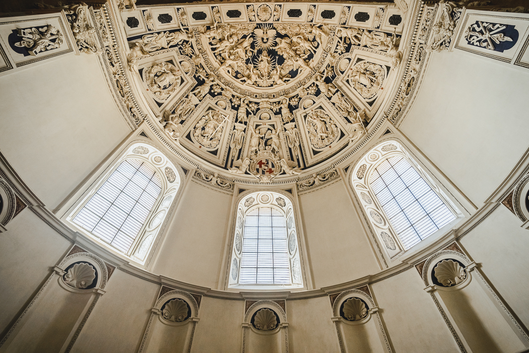
The maisonary in the Hohe Domkirche is incredible
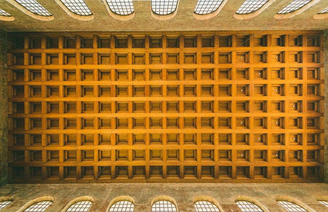
Inside the Konstantin-Basilika
Just around the corner is the Kurfürstliches Palais with some amazing grounds, which seemed to be where the locals were spending their time. The park leads into the ruins of the Kaiserthermen, a Roman bathhouse. One cannot access the complex – which is enormous – but walking the perimeter was sufficient to get a feel for the place. The next and final stop on the Roman tour was the arena, which is a kilometre or so out of town, in the middle of housing and vineyards. Here one is able to go inside (for a small fee of 3€) but in my opinion it was the least interesting of the Roman-era buildings. It had been done up in such a way to attract the attention of tourists and somehow it did not feel real as compared to the other ruins. After a lightning fast look around the arena, I was hauling arse back to the station to return the way I had come and head back to Mainz.

The Kaiserthermen